Showing posts with label recreation. Show all posts

Thursday, August 23, 2012

Things To Do In Ogden: Pickleball

My brother came into town recently.  During one of our conversations he says "Hey, have you checked out the pickball courts in Ogden?"  At first I thought he was joking. Why would he know more about my town than I do?   But, he persisted in seriousness and began to describe what seemed like a cartoonish lampoon of several other sports combined into one. 

 
The so-called sport of Pickleball, he said, is played on a special court similar to tennis but smaller in scale.  Instead of a tennis ball, the players use a regulation wiffle ball.   And, instead of tennis rackets, the players use paddles that appear as oversized ping pong paddles.  His description just seemed silly to me.  


As it turns out, the game is really fun!  The rules are similar to tennis and the effort exerted is similar to tennis.  The main difference is that you are much closer to your opponents and the energy that you would normally exert sending a ball speeding scores of feet to the other side of the net is instead compressed into a couple dozen feet.  The wiffle ball doesn't behave like a tennis ball at all and it takes some getting used to.  We spent a couple hours playing and it wore me out.  The game is very fast paced.


The courts are located next to the Pro Shop at the Mt. Ogden Golf Course.  Mornings and evenings are a popular time to play.  I recommend that everyone take a swing at it if they havn't already.


Thursday, July 5, 2012

Photo of the Day: Landscape Graffiti Let Down

While traveling on vacation I passed through Arco, Idaho.  I remember seeing these as a kid many years ago but their impact on me as an adult was more poignant this time. 


In a sort of parody version of "mountain letters" found above many cities across Utah, the residents of Arco have taken upon themselves the duty to paint the year of graduating high school classes on the cliff rocks above. 

Perhaps a more attractive and dignified tradition is in order?

Friday, June 15, 2012

Ogden Rising: The Ogden River Parkway


The improvements going on in Downtown Ogden continue to impress.  The Ogden River Parkway now connects to greenbelt trails in West Haven and Riverdale.  The trail system is quite remarkable and enjoyable to run or ride on. 

Today I wanted to showcase the portion of the trail between Washington Blvd. and just west of Wall Ave.  Ogden now has a tremendous asset flowing through the heart of the city. 


The Ogden River is now a great place for family outings.  Note: The wildlife in the area is still unfamiliar with people.  Unlike the ducks at Beus Pond which have had generations of people feed bread crumbs to them, the ducks on this stretch of the Ogden River run away from people well before you can can get close to them.  I guess that is a testament to their "newness" to the area.  Regardless, they are a welcome addition.    

Be sure to get out and enjoy this great part of the city!

Tuesday, April 17, 2012

Things To Do In Idaho: Wolverine Canyon and Forty Horse Cave

While visiting family in Idaho we took some time to explore some old familiar places of my youth.  While my parents moved us around extensively as I was growing up, my extended family stayed put.  I was born in Idaho Falls, Idaho and that is the area where my extended family remains today.  My first home was in Shelley, Idaho and my grandparents lived there for decades until recently.  

That being said, it was time for me to show my wife and kids some of the fun things to do in the area that I experienced as a child.  Wolverine Canyon was our destination.

    
Our journey passes through 900 E. in Shelley heading south.  An old sugar factory is the landmark where you start heading south.  Along the way we stopped to photograph this cool old barn. 


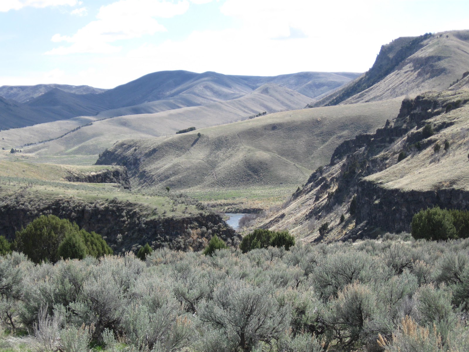
The Blackfoot River cuts through old lava rock on the way into Wolverine Canyon.


On the way into the canyon we ran into this sign.  Apparently, the green energy folks and the pastural conservation crowd are wrangling with each other.


As much as I find wind energy interesting, I do think wind turbines would do a disservice to the vibe of this landscape. 


The canyon gradually narrows and provides a dramatic change in scenery from the endless wheat and potato fields of the Snake River Valley. 


A couple miles into the canyon you will come to Forty Horse Cave.  The name originates from a legend that some horse thief hid 40 of his ill gotten horses there to elude being caught.  Given the steep terrain, I doubt this legend is true.  Nevertheless, the hike is short and fun. 


We parked our car and headed up the hill.


You can see our car parked at the bottom of the hill.  The loose rock and dirt makes for a scramble on some parts of the hike. 


The cave itself is only about 25 or so feet deep.  It appears to be created by water erosion since there were many puddles in the dirt with water dripping from the ceiling of the cave.


There are two trails up.  We discovered the easier one on our way down.  The kids handled both of them well.


The geology and rock features make for an interesting hike.


The whole trip took us about 2.5 hours round trip starting from Idaho Falls.  It was great to share some of my childhood adventures with my own children.

If you are ever in the area and need directions on how to get there, let me know.

Saturday, November 26, 2011

Photo of the Day: Mt. Ogden Views

I was driving about today and was fortunate enough to have my camera handy:


This was take from about 23rd Street and Taylor Ave. in Ogden. Enjoy!

Monday, October 24, 2011

Things to Do In Utah: Capitol Reef National Park


The family and I took a much needed vacation this last week.  Part of our adventure included a trip to Capitol Reef National Park.  The park is off the beaten path and getting there is a little tricky, especially when we couldn't find our map and our planned route was closed.  However, store clerks were a very helpful guide.

Our adventure started from St. George and took us to Cedar City.  State Road 14 was closed due to a massive rock slide which meant we had to travel via Parowan through Cedar Breaks.  That was a spectacular scenic detour.


Cedar Breaks is located just a few miles from Brian Head ski resort.


After visiting St. George, we were unprepared for the cool 40 degree temperatures found at the lookout.  The elevation was approximately 10,000 feet.

 
And, just in case you didn't know, cliffs and lightning can be harmful.

Our jouney then took us though some fascinating country to the quiet secluded town of Panguitch.  The clerk at the gas station was kind enough to direct us where to go from there.  We stayed at the Best Western which is just three miles from the Capitol Reef.  Here is the view from our hotel room.


We then traveled into the park and checked out The Goosenecks which is a winding canyon created by Sulpher Creek.


 We then headed to the Visitor Center to get oriented and traveled down Scenic Drive toward the Grand Wash.  At the entrance to the Grand Wash are some interesting features.  The abandoned uranium mine was a nice diversion.  It was dug into the thin white band near the base of the cliff. 


Of course, our family already had our radiation dosage allowance for the year so we decided not to break in and explore.
 

Further into the wash the geologic features continued to fascinate us...


Notice Kim and the kids at the very bottom of the above photo.  It gives you a sense of scale.


The next morning we awoke to a beautiful sunrise...


We then drove to Capitol Gorge...


Near the end of the gorge there is a side trail taking you up to "The Tanks" which are these large pools of water held in deep depressions in the rock.  The pool you see below is about 15 feet across.


After Capitol Gorge we headed along SR 24 and stopped to photograph the Fremont Indian petroglyphs.


Then, we headed up the Hickman Bridge trail...


Since I had the camera, I had to take a self portrait to prove I was actually there.

The trail also had some interesting surprises.  There was a cave feature off the trail that we found and played in for a few minutes. 


The "bridge" is a massive arch feature high above the valley floor.


The trail ends with a fantastic view of the Fruita Historic District and park Visitor's Center area below...


After the hike we traveled north out of the park...to Goblin Valley about an hour and a half away.


Our trip was so short and yet packed so full of interesting events and scenery that I am still stuggling to digest it all.  The geologic features still haunt my mind and I find myself yearning to go back so I can explore this part of Utah again.  It has certainly found a special place in my heart.